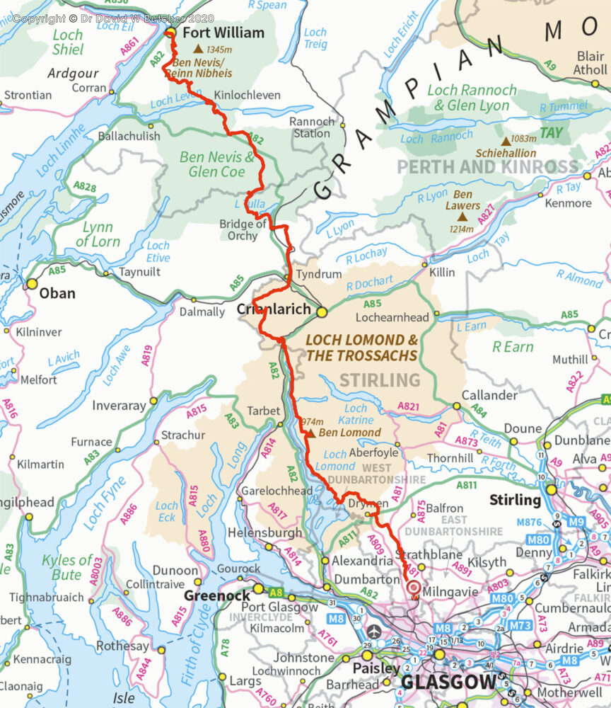
Glasgow to Cape Wrath in 3 easy stages!
It all started with my good friend Al from Gloucester asking me to go with him on a long walk as navigator as he didn’t trust himself not to get lost! He had never done such a thing before, had been walking more and now saw this as the next step. I agreed as long as I could choose the walk. I had read a lot about the West Highland Way and this seemed the obvious walk. I also knew there was a lot of scope for doing excursions from the official route to take in some big mountains. I went back to Big Al and told him we were doing the West Highland Way, which starts in Milngavie (on the edge of Glasgow) to Fort William but deviating from the official route to do a mountain (such as any convenient Munro – a Scottish mountain of at least 914m / 3000 feet) every day, where available.
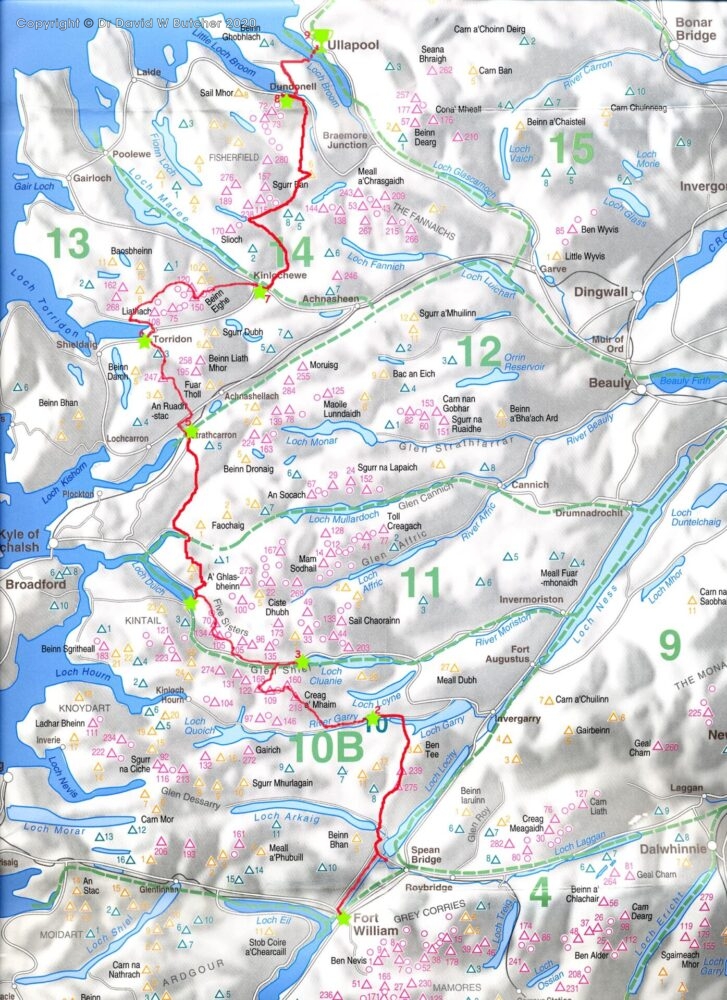
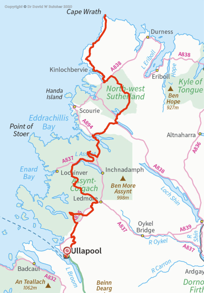
Once completed we decided to carry on over the following 2 summers to Cape Wrath, via Ullapool with the main criteria being to stay high as much as possible and find hotels to stay in every night. The route was whatever I could find on the maps as there are no guide books and I wanted the extra challenge of planning a long distance route rather than following someone else’s! After I had our route sketched out I discovered that a route from Fort William to Cape Wrath had already been published as the Cape Wrath Trail. I quickly checked it and ruled it out as it didn’t include much high ground, like the West Highland Way it stayed in glens and low hills.
Most of the photographs were taken on the trips described here but we had so much bad weather that I added in pictures, where available, taken on other trips to fill in a few gaps for those days. The 2 colour photographs of the start in Milngavie I took in 2019. The West Highland Way Start Pillar is the same but the overhead sign between Costa Coffee and Greggs had been added since our trip; in 2003 the start was not obvious to us and we had to ask where it was even though we were almost on top of it!
 Get some free printing and developing tips, tutorials and information from the expert over at Darkroom Dave!